




The New Overland Transoceanic Route: Mexico’s Strategy to Challenge the Panama Canal
For over a century, the Panama Canal has maintained an uncontested monopoly on maritime transit between the Atlantic and Pacific Oceans. Handling roughly 5% of all global maritime trade, this engineering marvel reshaped supply chains, cut thousands of miles off trade routes, and transformed international commerce.
However, severe water shortages, shifting global trade patterns, and geopolitical realignments have forced logistics networks to seek viable alternatives. Enter Mexico’s ambitious flagship project: the Interoceanic Corridor of the Isthmus of Tehuantepec (Corredor Interoceánico del Istmo de Tehuantepec, or CIIT).
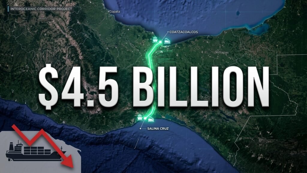
Spanning a narrow 186-mile strip of land between the Pacific Ocean and the Gulf of Mexico, this $4.5 billion logistics network combines upgraded deepwater ports, heavy rail infrastructure, and high-capacity industrial hubs. Rather than simply serving as a secondary shortcut, Mexico’s multi-modal land bridge aims to redefine global logistics, attract international manufacturing, and rival traditional maritime passages.
The Legacy of the Panama Canal and the Modern Logistics Bottleneck
To understand why Mexico is investing billions into an overland transit system, one must first look at the history and current constraints of the Panama Canal.
The Historic Quest for an Interoceanic Passage
For centuries, explorers and merchants sought a direct route connecting the Atlantic and Pacific Oceans to avoid the long, treacherous voyage around South America’s Cape Horn.
-
The French Failure (1880s): Led by Ferdinand de Lesseps—fresh off his success with the Suez Canal—the initial French effort attempted to construct a sea-level canal through the dense Panamanian jungle. The project collapsed under the weight of tropical diseases like yellow fever and malaria, severe financial mismanagement, and treacherous terrain.
-
The American Triumph (1904–1914): Recognizing the strategic and economic necessity of an interoceanic route, the United States under President Theodore Roosevelt acquired the project rights. American engineers abandoned the sea-level plan in favor of a complex lock system powered by Gatun Lake. Through massive sanitary campaigns to eradicate mosquito-borne illnesses and groundbreaking civil engineering, the Panama Canal officially opened in August 1914.
+-----------------------------------------------------------------------+
|                    PANAMA CANAL EVOLUTION TIMELINE                   |
+-----------------------------------------------------------------------+
|  1881: French excavation begins under Ferdinand de Lesseps           |
|  1904: United States takes over construction under Theodore Roosevelt  |
|  1914: Panama Canal officially opens to global maritime traffic       |
|  2007: Major expansion project breaks ground                          |
|  2016: Expanded locks open to accommodate Neo-Panamax vessels          |
+-----------------------------------------------------------------------+
The 2016 Expansion and Modern Operational Limits
By the early 2000s, global container ships had grown too large for the canal’s original locks. In 2007, Panama initiated a multi-billion-dollar expansion project, completing it in 2016. This expansion introduced a third set of locks featuring massive rolling gates and water-utilization basins, allowing Neo-Panamax vessels—capable of carrying up to 14,000 twenty-foot equivalent units (TEUs)—to pass.
Despite these upgrades, the Panama Canal faces structural vulnerabilities:
-
Freshwater Dependency: Unlike sea-level canals like the Suez, the Panama Canal relies entirely on freshwater from Gatun Lake to fill its lock chambers. Every vessel transit flushes roughly 52 million gallons of fresh water into the ocean.
-
Climate Susceptibility: Severe droughts triggered by recurring El Niño patterns frequently force the Panama Canal Authority to restrict daily vessel transits and lower maximum draft limits, resulting in massive maritime traffic jams and skyrocketing freight rates.
These growing operational risks created a clear market opportunity for a resilient, high-volume overland transit corridor.
Anatomy of the Interoceanic Corridor of the Isthmus of Tehuantepec (CIIT)
Located at the narrowest geographic point in Mexico, the Isthmus of Tehuantepec offers the shortest land route between the Gulf of Mexico and the Pacific Ocean. While earlier historical attempts to utilize this route fell short due to inadequate tech and changing trade demands, Mexico’s modern infrastructure overhaul turns it into a competitive logistics engine.
                 GULF OF MEXICO
                      |
              [ Coatzacoalcos ]  <--- Deepwater Atlantic Port
                      |
              =================
              |  LINE Z RAIL  |  <--- 186-Mile Multi-Modal Transit
              =================
                      |
              [ Salina Cruz ]    <--- Deepwater Pacific Port
                      |
                PACIFIC OCEAN
Key Ports and Infrastructure Upgrades
The CIIT relies on two upgraded anchor ports connected by high-capacity rail and highway networks:
-
Coatzacoalcos (Veracruz): Serves as the Gulf of Mexico (Atlantic) terminal point. Port improvements include dock expansions, dredging projects to accommodate deep-draft cargo ships, and specialized container-handling facilities.
-
Salina Cruz (Oaxaca): Serves as the Pacific terminal point. Upgrades feature a massive new breakwater, modernized container terminals, and expanded access channels to handle large-capacity container ships arriving from Asia.
Connecting these maritime hubs is Line Z of the Interoceanic Railway (Ferrocarril del Istmo de Tehuantepec), an overhauled 186-mile rail line capable of handling double-stacked container trains and high-speed freight transportation.
Panama Canal vs. Interoceanic Corridor: A Strategic Comparison
While the Panama Canal remains a continuous maritime passage, Mexico’s Interoceanic Corridor operates as an integrated multi-modal transit system. The table below outlines how these two major trade infrastructures compare.
| Operational Feature | Panama Canal | Interoceanic Corridor (CIIT) |
| Primary Mode | Continuous maritime lock canal | Multi-modal (Rail, Port, Highway) |
| Transit Distance | ~50 miles (80 km) | ~186 miles (300 km) |
| Primary Capacity | Neo-Panamax vessels (~14,000 TEUs) | Double-stacked freight trains |
| Environmental Risk | Highly vulnerable to freshwater drought | Independent of freshwater availability |
| Value-Add Strategy | Transit toll revenues | Nearshoring manufacturing & industrial production |
| Target US Destinations | US East Coast & Gulf Coast ports | US Gulf Coast, Midwest, & Southern US |

Economic Engine: Development Poles for Welfare (PODEs)
The CIIT project goes beyond simple container transport between oceans; it functions as a comprehensive regional development strategy designed to turn Southern Mexico into an industrial powerhouse.
Central to this vision are the 10 Development Poles for Welfare (Polos de Desarrollo para el Bienestar, or PODEs)—specially designated industrial parks spanning roughly 300 hectares (740 acres) each.
Strategic Locations Across the Isthmus
The industrial parks are strategically distributed across the two connecting states:
-
Oaxaca Region: Includes designated nodes at Salina Cruz, San Blas Atempa, Ciudad Ixtepec, Matías Romero, Ixtaltepec, and Loma Bonita.
-
Veracruz Region: Includes designated nodes at Coatzacoalcos I, Coatzacoalcos II, Texistepec, and San Juan Evangelista.
GULF OF MEXICO
      |
[ Coatzacoalcos I & II ] ---- (Veracruz PODEs: Texistepec, San Juan Evangelista)
      |
      |=====[ Line Z Interoceanic Rail Axis ]=====
      |
[ Salina Cruz ] ------------- (Oaxaca PODEs: Matías Romero, Ciudad Ixtepec, etc.)
      |
PACIFIC OCEAN
Tax Incentives and Foreign Direct Investment
To attract global manufacturers, semiconductor producers, automotive brands, and logistics providers, the Mexican government instituted a competitive tax incentive scheme:
-
Income Tax (ISR) Exemption: Companies establishing operations in these designated parks receive a 100% income tax exemption for the first 3 years of operation, followed by a 50% to 90% reduction for the subsequent 3 years depending on job creation metrics.
-
Value-Added Tax (VAT / IVA) Relief: Fully exempts internal transactions within and between the industrial zones from value-added tax for a multi-year period.
-
Guaranteed Infrastructure: Accelerated access to essential industrial utilities, including high-voltage power lines, industrial water supplies, natural gas pipelines, and fiber-optic networks.
By combining low-cost manufacturing space with direct overland rail access to the North American market, Mexico aims to attract billions in nearshoring investment—particularly from companies seeking to diversify their supply chains away from long Asia-to-US maritime routes.
Frequently Asked Questions
What is the Interoceanic Corridor of the Isthmus of Tehuantepec (CIIT)?
The CIIT is a multi-billion-dollar infrastructure project in Southern Mexico that links the Pacific and Atlantic Oceans across the Isthmus of Tehuantepec. It includes upgraded deepwater ports at Salina Cruz and Coatzacoalcos, a modernized freight railway system, highway expansions, and 10 industrial parks designed to support global manufacturing and trade.
How does Mexico’s corridor differ from the Panama Canal?
The Panama Canal is a continuous water passage using a system of locks to float ships across Central America. The CIIT is an overland multi-modal logistics bridge where cargo ships dock, offload containerized freight onto double-stacked trains, ship the cargo across Mexico by rail in under 7 hours, and reload it onto ships on the opposite ocean.
Can the Interoceanic Corridor fully replace the Panama Canal?
No, the corridor is designed to complement, rather than completely replace, the Panama Canal. While the Panama Canal handles massive single-ship volumes continuously, Mexico’s corridor provides a faster, drought-proof alternative for high-value freight, express shipping, and goods bound directly for the North American market.
What are “PODEs” and why are they important?
PODEs (Polos de Desarrollo para el Bienestar) are industrial zones established along the rail line. They are designed to transform Southern Mexico from a simple transit zone into a major manufacturing hub by offering generous tax cuts, accelerated utility access, and direct logistical connections for foreign investors.
What industries are target investors for the Interoceanic Corridor?
Key target sectors include automotive assembly, semiconductor manufacturing, microelectronics, medical devices, agribusiness, textiles, and green energy infrastructure.
How long does it take for cargo to cross the Isthmus of Tehuantepec by rail?
Freight trains traveling along Line Z can move containers between the port of Salina Cruz on the Pacific and Coatzacoalcos on the Atlantic in approximately 6 to 7 hours, drastically cutting down total transit time compared to maritime canal queuing.
The Future of Global Supply Chains
Mexico’s Interoceanic Corridor represents a fundamental shift in how international trade flows across the Western Hemisphere. By turning a narrow geographic strip into a high-capacity logistics and industrial corridor, Mexico offers global trade networks a vital alternative to unpredictable maritime bottlenecks.
As nearshoring trends accelerate and supply chains prioritize resilience, the Isthmus of Tehuantepec stands ready to take center stage in international commerce—transforming Southern Mexico into a core engine of regional and global trade.